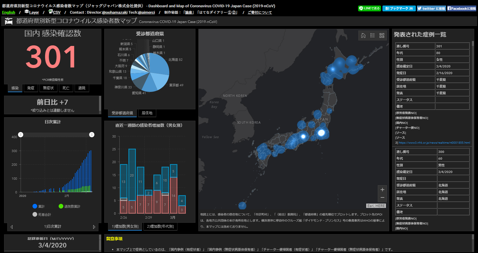
都道府県別新型コロナウイルス感染者数マップ
本マップの情報は、WHO、日本政府(首相官邸内新型コロナウイルス感染症対策本部、厚生労働省、各地方自治体)の発表する情報を基に更新されています。
Operations Dashboard for ArcGIS - jagjapan.maps.arcgis.com |
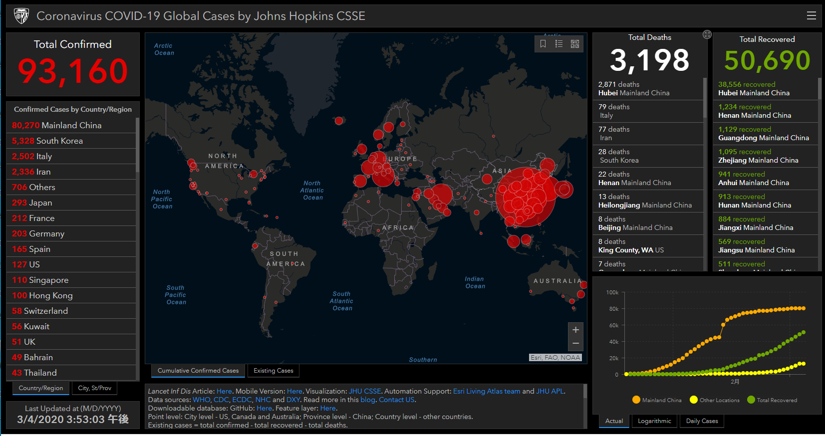
Coronavirus COVID-19 Global Cases by Johns Hopkins CSSE
全世界新型コロナウイルス感染者数マップ
Coronavirus COVID-19 Global Cases by Johns Hopkins CSSE
Operations Dashboard for ArcGIS - gisanddata.maps.arcgis.com |
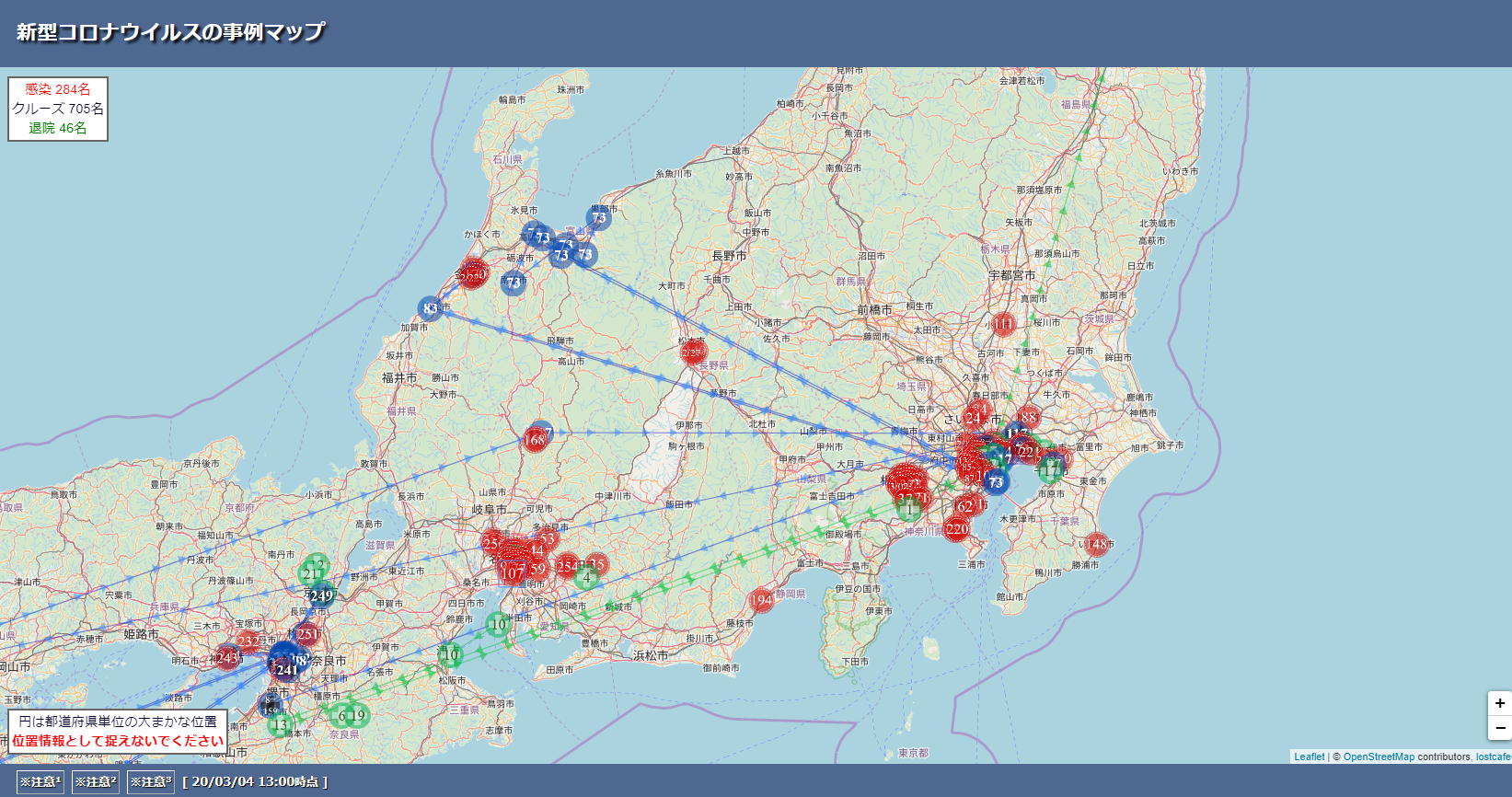
| 新型コロナウイルスの感染状況をまとめたマップです coromap - 新型コロナウイルスの感染状況マップ - coromap - 新型コロナウイルスの感染状況マップ |
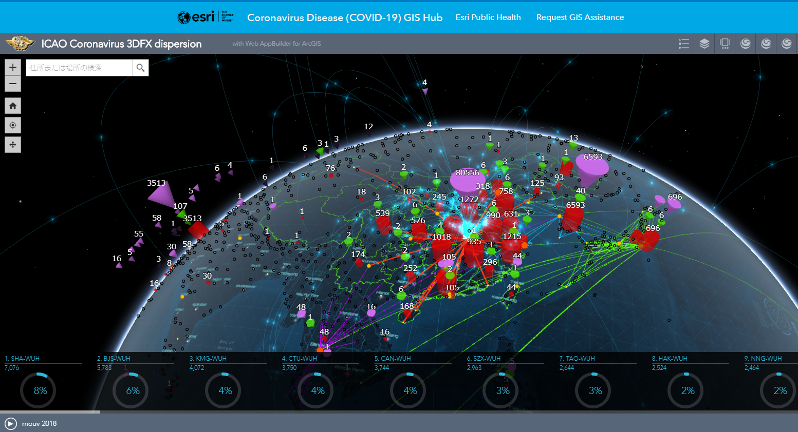
Coronavirus Disease (COVID-19) GIS Hub
| https://arcg.is/STfKL SHORT CUTThe data for the Confirmed Cases, Deaths, Recovered are from WHO, CDC, NHC, earlyAlert for Airport and Dingxiangyuan and are updated daily.The Routes analysis are from ICAO Gilbert Lasnier and other Layers also... ICAO Coronavirus 3DFX dispersion - coronavirus-disasterresponse.hub.arcgis.com |